8/26/2018 First appeared in VtDigger.org
Six weeks ago, following an instinct known to any Vermonter who has lived here more than a couple of years, our eighteen year old son flew to California and started searching for a rust-free Toyota truck. He found one 32 years old with 300,000 miles, a rebuilt motor and an underside which looked as though it rolled off the factory floor yesterday. Prodded by the chance to spend a father-and-son week road-tripping across this magnificent country, urging by my wife, and wondering how well my 52 year old body would survive 3000 miles and a week of shaking and cooking in a small unairconditioned truck cab, I flew to Los Angeles.
Our son, Ford, had been staying with his great uncle in northern California about an hour from Sacramento. His uncle generously loaned him a car to use while he was looking for a truck and to drive to LA to pick me up. I had the new, Green Mountain plates in my suitcase.

We headed north from LA on the Five. (Southern Californians precede freeway numbers with a definite article. To my eastern ears this word choice heightens the sense that Californians have a familial relationship with their roads and cars.) We switched to the 99 and then onto smaller roads as we cut across the southern Central Valley toward Sequoia National Park. We were driving over the dry bed of Tulare Lake which was gone by 1899, its inflowing rivers diverted for agriculture. As recently as 1850 Tulare Lake was the largest (by area) freshwater lake west of the Mississippi and inside the boundaries of the United States. The diverted water that used to fill Tulare Lake, and the water from other rivers farther north, allow the Central Valley to grow half of the produce and nuts grown in the United States.
The Central Valley is a huge, mostly flat area 40 to 60 miles wide, more than four hundred miles long and ringed with mountains—Sierra Nevada to the east and on the west by the Coast Ranges. The precipitation falling in this watershed, whatever is left after evaporation, irrigation and other uses, flows into the San Francisco Bay.
California is having another dry summer this year, but the Central Valley is not always dry. In the winter of 1861-62 heavy rain and snow melt caused a huge lake to form in the Central Valley. An area of 6000 square miles, roughly two thirds the size of Vermont, was under water, some of it thirty feet deep. The geological record indicates that floods of this size have occurred every one hundred to two hundred years. Millions of people now live on what has been lake bed and probably will be again.
Ford wanted to see Colorado and so he pointed our compass in that direction by way of Lake Tahoe. When you approach Lake Tahoe as we did, coming from the arid foothills west of the Sierras with the smoke from California’s wildfires still fresh in our noses, the lake’s wetness and size, 22 by 12 miles and 1600 feet deep, seems out of place, almost impossible to believe. And yet this vast expanse of water leaves Lake Tahoe through the Truckee River and flows out of the mountains and north to the desert and into Pyramid Lake…and that’s it. There is no outlet for Pyramid Lake. The water entering Pyramid Lake either seeps into the ground or is evaporated by the relentless desert sun. Evaporation, that’s the part of the water cycle you see in the west.
We’d picked up US Route 50 in Placerville, CA and after Tahoe we consulted the map. Well, I consulted my map. Ford, who’d impressed and terrified me by steering his uncle’s little Mazda through 80mph LA traffic one-handed while stroking his phone screen with the other hand, looked at his phone. The map is still faster than the phone for the big picture and on the map we could see that US 50 went through Colorado.
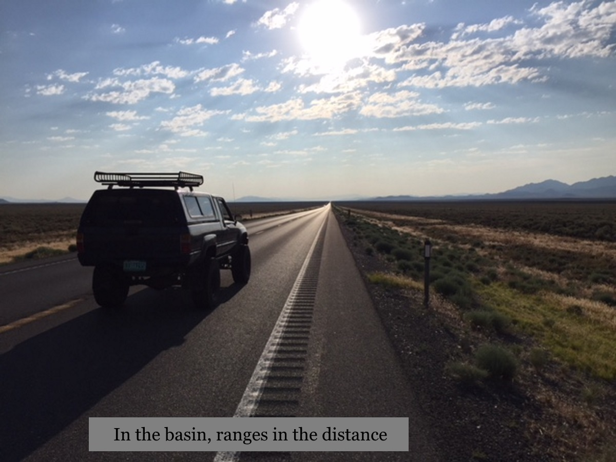
We followed 50 across Nevada where the topography is defined by basin and range geology. Numerous narrow mountain ranges run roughly north-south and in between the ranges are flat valleys. The dominant theory is that the tectonic plates are being stretched apart here and the basin and range formations are the result. It is a satisfying, if lonely landscape to drive across. A few miles of curving road brings you to a pass in the mountain range and then the straight road and the next valley lie spread out in front of you and beyond it the next range. The valleys vary in width but most of the ones we drove across were ten to thirty miles wide with very little vegetation or human habitation.
Some of the mountains appear to be little more than piles of rock and sand and the valleys grow scattered creosote bush and sagebrush. Of course there is life on this land, but it has to protect itself from the sun. The basin and range landscape seems so neatly organized that it is easy to imagine the valleys filled with crops while the rare clusters of greenery at the base of some mountain ravines makes it possible to picture people living there. I couldn’t help but think about the hydrothermal vents in the deep ocean where there is no light from the sun, but because there is water and geothermal energy there is an abundance of life. And yet in these Nevada mountains, with plenty of sun and minerals but very little water, life is scarce. Water is everything.
US 50 and Interstate 70 go together near Salina, Utah and pass through extraordinary canyons shaped by water cutting rock, and, more recently, by people cutting rock. In one place the highway cuts through a canyon hundreds of feet deep but so narrow, before the highway engineers blasted it wider, that a person could stretch out their arms and touch both canyon walls. In Grand Junction, Colorado we stopped for the night at a campground on the banks of the mighty Colorado River. At this point, in July, the Colorado was shallower than the Winooski in Montpelier in a dry spell. I could have walked across without getting my knees wet. But the power of water was evident in the cliff faces hundreds of feet tall on the other side of the river.
Maybe I read too many westerns as a kid and so I think of the west as one place, a concept, The West. But the land of the west is wildly diverse—desert to rainforest, glaciers, alpine mountains, canyons and plains. I’ve lived almost all of my life in Vermont. The land of the east changes gradually. Drive from Vermont to Florida and the landscape transforms incrementally from a temperate forest to subtropical swamp, and even a Florida swamp bears a resemblance to a Vermont beaver pond. The western land changes more abruptly. The mountains stop, (or start, depending on which way you’re traveling), in Colorado Springs. Here we turned left and north, a little reluctant to leave the mountains, but after a few miles we noticed that we would get to Denver about four o’clock and that it was Friday and the road was already packed with rushing traffic, so we turned right and went back on the two lane and out onto the Great Plains.
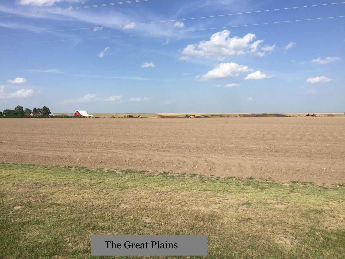
On the plains you can feel the water. It is in the aquifer below you and in the clouds above, but the clouds drift on by and the aquifer is going down. We passed through the dry land of eastern Colorado with beautiful irrigated-green alfalfa fields and little towns built around little creeks. The four cylinder Toyota was rolling more easily on this flat landscape but the wind was so strong I had to shut my window to keep my hat from blowing off. We saw hundreds, maybe thousands of wind turbines, the size of the big machines up on Lowell Mountain, near towns, in crop fields, almost on top of houses, everywhere.
Then we camped for the night beside a reservoir in south-western Nebraska. For the whole trip we slept incredibly well in the back of the truck despite the heat and cramped space. I have no explanation for this, I just wish I could wake up feeling as rested every morning. Even the freight trains going by all night didn’t disturb us. Ford says he didn’t hear them. I woke a couple of times and fell asleep again before the train had passed by. In the morning I counted one train with seventy-five oil tankers pulled by four engines and pushed by a fifth.
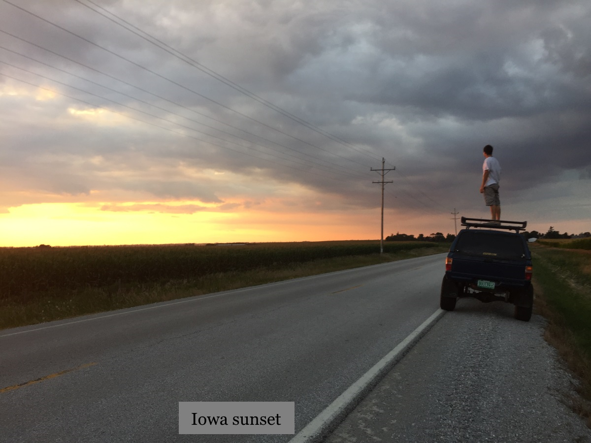
Starting from California, we drove 1500 miles of two lane, mostly US 50. As the corn and soybean fields started thickening up, a little west of Lincoln, Nebraska, we got on the I-80 super slab. By central Iowa we were crossing rivers I’d never heard of, Indian Creek, Cedar River, South and North Skunk River, that seemed bigger than the Colorado.
“That’s huge,” Ford said as we crossed the Mississippi.
“Downstream from here, where the Ohio River joins the Mississippi River, the Ohio is actually much larger than the Mississippi,” I said, but I could tell he wasn’t listening. There’s nothing like seeing it for yourself.
When Ford flew to California his layover was in Chicago and so he flew over a corner of Lake Michigan. He texted from the airport, “How is it possible that less than 3% of the water in the world is freshwater?”
What’s the answer to that question?
My response, that most of that 3% is locked in the ice caps, was like giving a thirsty guy salt instead of water.
It rained as we passed through Cleveland the next day. The first steady rain we’d had on the trip. And the day after, when we got off the thruway at Amsterdam, New York to cut across to Saratoga Springs, it poured. We parked under the awning of a gas station and, in the time it took to fill the tank, the rainwater overwhelmed the storm drains and flooded a foot deep on the road. Ford had been driving all day. “Want me to take a turn?” I asked.
“Are you kidding. I can’t wait to drive in this,” he replied. He hit the first puddle hard and water surged up over the hood, much to his satisfaction. Precipitation, that’s the part of the water cycle you see in the east. We got home in a light drizzle, the kind of rain plants love and the kind of precipitation that, in the winter, ends up as a salty slush rusting cars to pieces.